Planning a 7-to-10-day coastal Maine trip for two 62+ travelers in a standard passenger car—where one uses a rollator or avoids stairs—depends on matching paved paths with timed park bookings.
Most regional guides pitch Acadia’s Ocean Path as paved and treat the Senior Pass as an all-access ticket, yet both claims break down on arrival.
Ocean Path turns from concrete near Sand Beach to dirt, roots, and rocks toward Otter Point, while your Senior Pass excludes the $6 Recreation.gov reservation required on Cadillac Summit Road—where RVs and trailers are banned.
Three Base Hubs for a Rollator-Friendly Passenger Car Route
Splitting the 230-mile Kittery-to-Bar Harbor corridor across three hubs cuts nightly packing and caps transfers under 2.5 hours. Follow these road trip pacing rules to save energy for flat walks.
Spend two nights in Ogunquit or Kennebunkport for level village sidewalks, then stay three nights in Boothbay Harbor or Camden near Mid-Coast gardens. Finish with three or four nights on Mount Desert Island in Bar Harbor or quieter Southwest Harbor.
Choosing Southwest Harbor over downtown Bar Harbor trades bustling dining for easier parking and faster morning drives to Bass Harbor Head Light. Both island towns keep Acadia drives under 20 minutes without crossing the Route 3 causeway daily.
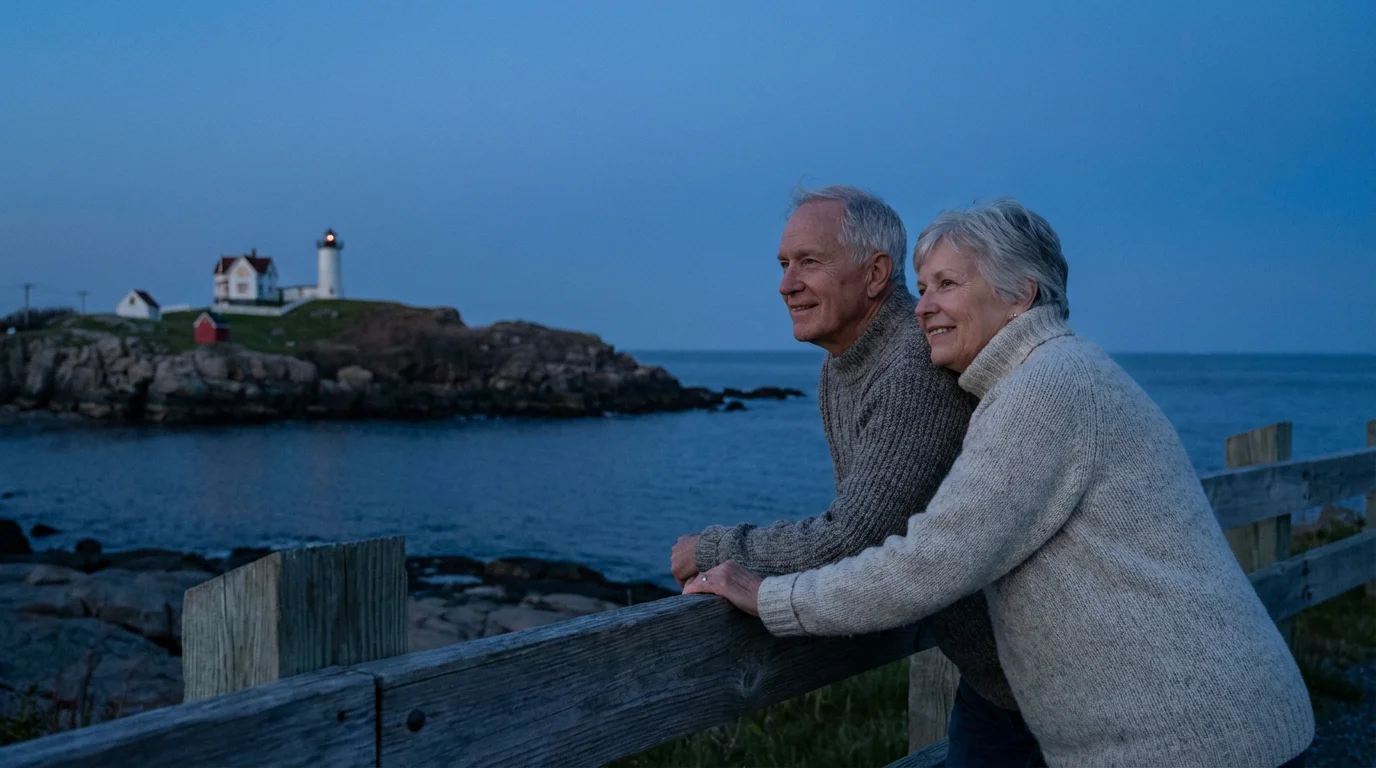
- Days 1 to 2, Ogunquit or Kennebunkport: Drive I-95 North to US Route 1 (15 to 30 miles; 30 to 50 minutes) before 9:30 a.m. for Ogunquit’s 1.25-mile Marginal Way and roadside views at Sohier Park by Nubble Light.
- Days 3 to 5, Boothbay Harbor or Camden: Depart by 9:00 a.m. on I-295 North to Brunswick and US Route 1 (95 to 125 miles; 2 to 2.5 hours) for Coastal Maine Botanical Gardens and Mount Battie summit road, skipping Pemaquid Point’s granite.
- Days 6 to 9, Bar Harbor or Southwest Harbor: Take US Route 1 or I-95 via Bangor and Route 3 (80 to 110 miles; 2 to 2.5 hours), riding the Island Explorer and booking Cadillac Summit Road ahead.
- Day 10 (Optional), Schoodic Peninsula and Return: Fuel in Ellsworth, drive the 6-mile one-way Schoodic Loop Road for paved ocean turnouts, then return south on I-95 from Bangor in daylight.
Bypassing US Route 1 Bottlenecks and Rural Dead Zones
US Route 1 serves as Main Street through Mid-Coast towns, funneling traffic onto narrow bridges and downtown crosswalks. Summer delays across Wiscasset’s Sheepscot River bridge and downtown Camden frequently add 30 to 60 minutes.
For direct hub transfers without sightseeing, stay on Interstate 295 north from South Portland to Brunswick or Gardiner before rejoining coastal highways. To reach Mount Desert Island quickly, follow I-95 north to Bangor and turn onto Route 3.
Save scenic US Route 1 legs for departures before 9:30 a.m. or after 4:00 p.m., when day-tripper volume drops. Download offline maps before leaving major towns because cellular coverage fades quickly across Downeast peninsulas and Mount Desert Island.
Top off fuel and use restrooms in Ellsworth before continuing east past Frenchman Bay onto the Schoodic Peninsula. Roadside services thin rapidly there, and narrow shoulders leave minimal pullout space.
Verified Walk Surfaces vs. Granite Traps
Smooth waterfront paths often sit minutes from fractured granite that looks flat from a parking pullout. Checking surface transitions before unloading protects joints and keeps accessible coastal outings predictable for a rollator user.
Southern and Mid-Coast Surfaces
Ogunquit’s Marginal Way is Southern Maine’s top rollator walk, spanning 1.25 paved miles roughly 5 feet wide between Ogunquit Beach and Perkins Cove. Thirty-nine benches line the cliff path for frequent seated breaks.
The Marginal Way Preservation Fund supplies free loaner wheelchairs by advance reservation before arrival. Trailhead town parking fills by late morning, making pre-9:30 a.m. or evening arrivals practical.
Mid-Coast stops demand closer inspection before unloading mobility gear. Portland’s Old Port pairs steep grades with historic cobblestones, while Pemaquid Point Lighthouse sits on slanted, fissured granite with neither a paved shoreline path nor guardrails.
Acadia Trail and Carriage Road Rules
Acadia’s 2.2-mile one-way (4.4-mile roundtrip) Ocean Path surprises rollator users because it is not paved end to end. Only a short section near Sand Beach mixes concrete with packed gravel before shifting to dirt, roots, and rocks toward Otter Point.
At Thunder Hole, accessible parking spaces connect to a paved ramp leading to the upper viewing deck above the inlet. Stay on that upper deck instead of descending steep, often wet stone stairs to the lower platform.
Acadia’s 45-mile Carriage Roads provide car-free crushed-stone bike trails and walking routes with a 20 mph speed limit. Class 1 e-bikes are allowed on carriage roads and Schoodic bike paths, while Class 2 and 3 e-bikes are restricted to Park Roads.
The National Park Service requires no permit for standard ADA wheelchairs or medical mobility scooters on accessible routes. Non-traditional scooters, golf carts, and other power-driven mobility devices (OPDMDs) require a Special Use Permit requested from the park.
Coastal Route and Access Verification Table
Match each stop against verified surface conditions, arrival windows, and the authority controlling access before leaving your hub.
| Stop or Route | Timing and Distance | Verified Surface and Limits | Fee, Permit, and Decision Maker |
|---|---|---|---|
| Marginal Way, Ogunquit | 1.25 miles one-way; arrive pre-9:30 a.m. or post-4:00 p.m. | Paved, ~5 feet wide, 39 benches | Town lots fill late morning; Marginal Way Preservation Fund handles advance loaner wheelchairs |
| Pemaquid Point, Mid-Coast | Short detour off US Route 1 bypass | Slanted, fissured granite; no paved shore path or guardrails | Stay on upper grounds; skip shoreline scramble |
| Ocean Path and Thunder Hole, Acadia | 2.2 miles one-way (4.4 miles roundtrip) | Concrete/packed gravel near Sand Beach; dirt, roots, rocks toward Otter Point; upper deck ramped | Accessible parking at upper deck; Acadia NPS sets Dec 1 road closures and OPDMD permits |
| Cadillac Summit Road, Acadia | Separate sunrise or daytime timed windows | Paved summit road; RVs and trailers banned | $6 Recreation.gov reservation (May 20–Oct 25, 2026) plus pass; zero gate sales |
| Schoodic Loop Road, Mainland | 6-mile one-way loop; ~1 hour from Bar Harbor | Paved turnouts; narrow shoulders east of Frenchman Bay | Park pass required; Island Explorer serves peninsula seasonally |
Skipping Acadia Parking Stress on the Island Explorer
Trailhead lots at Sand Beach, Jordan Pond, and Bubble Pond fill before mid-morning in peak season, stalling cars along one-way sections of Park Loop Road. Leaving your vehicle at your island lodging removes lot-hunting guesswork.
The fare-free, propane-powered, wheelchair-accessible Island Explorer shuttle connects Mount Desert Island towns, campgrounds, and major Acadia stops. Buses run seasonally from mid-June through mid-October across the island and Schoodic Peninsula, operating through October 13 in 2026.
Check the 2026 Island Explorer schedule each evening for annual spring, summer, and fall route dates. Drivers load mobility devices without extra steps and stop on request, letting you link morning walks with lunch at Jordan Pond House.
The shuttle also reaches Acadia’s quieter Schoodic Peninsula on the mainland, roughly an hour around Frenchman Bay from Bar Harbor. Whether driving the 6-mile one-way loop or riding the bus, Schoodic’s paved turnouts carry minimal traffic.
Worked Pass Math and Cadillac Summit Road Rules
Standard Acadia admission costs $35 per vehicle for seven days, plus a $100 per-person 2026 surcharge for non-U.S. residents age 16+ without a qualifying pass. Nonresidents may instead buy a $250 America the Beautiful Non-Resident Annual Pass.
Two U.S. citizens or residents age 62+ paying Acadia’s $35 gate fee plus the $6 Cadillac reservation spend $41 for one trip. Buying a digital $20 Senior Annual Pass on Recreation.gov lowers that trip total to $26.
A digital $80 Senior Lifetime Pass on Recreation.gov brings that trip to $86 without processing fees and covers six federal agencies. In person, travelers can credit up to four Senior Annual Passes—even expired ones—at $20 each toward the $80 Lifetime Pass.
Ordering a physical Senior Pass by mail or the USGS Online Store adds a $5 processing fee and $7.50 handling ($32.50 annual or $92.50 lifetime). Digital passes on Recreation.gov charge zero processing fees, adding $7.50 shipping only for an optional plastic card.
Recreation.gov controls all $6 Cadillac Summit Road reservations from May 20 through October 25, 2026, with zero passes sold at the gate. Separate slots cover sunrise and daytime arrivals, leaving commercial tour buses as your fallback if slots sell out.
Seasonal Windows, Coastal Fog, and Winter Gates
Targeting late May through mid-June or September through mid-October brings open restaurants, lighter US Route 1 traffic, and mild temperatures. Most of Acadia’s Park Loop Road closes to cars on December 1 each winter, and coastal storms periodically close trails.
Check Acadia’s Current Conditions page each morning for storm repairs and seasonal gate updates before driving out. Keep a windproof outer layer in the trunk because Cadillac Mountain and Schoodic Point run 10 to 15 degrees cooler than inland towns.
Coastal fog often drops summit visibility at Cadillac Mountain and Schoodic Point to a few yards near dawn. Check local marine forecasts before locking in a sunrise drive, since mid-morning or afternoon slots frequently clear above the water.
Stay behind barriers at Thunder Hole and off dark, algae-slick granite at Pemaquid Point where sudden swells hit unexpectedly. Complete inter-hub highway legs during full daylight to avoid dusk deer and moose crossings along Downeast roads.